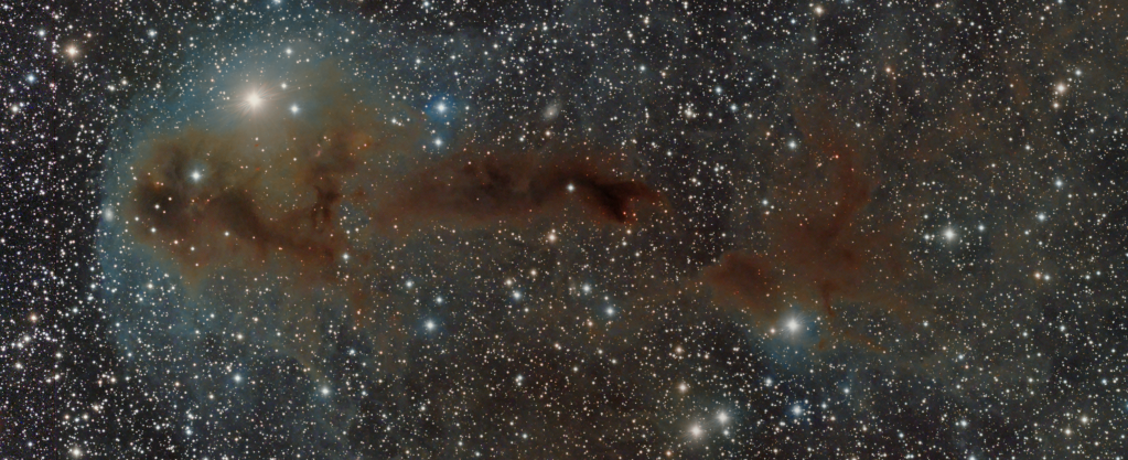
Astrophotography is difficult, very difficult but probably one problem stands out above all others. The platform we are taking the images from, Earth, is moving at about 67,000 mph on its way around the sun every 365 days and just over 1,000 mph rotating on its axis every 24 hours, which is tilted at approximately 23o relative to its orbit around the sun. Over a year the annual journey around the sun, combined with the planet’s tilt provides us with the seasons and the astronomer with a different views of the universe, which despite the overall velocity does not unduly affect imaging over short periods measured in seconds or even minutes. However, the rotation of the Earth every 24 hours is another matter, particularly when photographing objects over any period of time greater than a few seconds, which is required for most objects, especially more distant DSO.
In understanding how this last movement impacts on the nature of the sky we see and in order to photograph objects – as well as forming a basis for navigation around the night sky – we have developed a system that is analogous to that used for navigating across the globe i.e. Longitude and Latitude but now called Right Ascension or RA and Declination or DEC.
For the purpose of establishing lines of RA and DEC a celestial sphere must be imagined of an arbitrarily large radius, concentric with a celestial body – in this case Earth. In a similar way to Earth, a celestial equator is likewise established, this being in the same plane as the Earth’s equator but projected upwards onto the celestial sphere – as a result if the Earths tilt, it too is inclined at 23.4o with respect to the elliptical plane. Having established the sphere and the equator, RA is then described as the angular distance along the celestial equator and DEC measures the distance above or below the celestial equator along any RA line in degrees. This imaginary framework can then be used to describe the positon of any object or its relative position over time in space in the sky that we see from Earth.
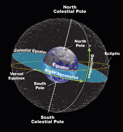
The Celestial Sphere – a grid of RA & DEC lines across the sphere can be used to define the position of objects in the sky. Looking south in the Northern Hemisphere, the Celestial Equator is inclined across the sky from east to west and bisected vertically due south by the Meridian line (not shown) – the optimal RA line for astroimaging
In order to follow an object for imaging it is necessary to hold the telescope / camera in a stationary position relative to the movement of the object; remember that we are at the same time spinning at 1,000mph relative to space. This is very difficult but in astrophotography is usually achieved by the means of an Equatorial Mount which, through some very sophisticated software that computes the relative movements of the object and the telescope, gently slews the mount-telescope-camera combination using gears and belts in such a way that the telescope and hence camera, remain fixed upon the chosen object. The result, when undertaken with care, will be a wonderful sharp image of an almost endless number of features in the night sky, which is the subject of many of the posts on this website
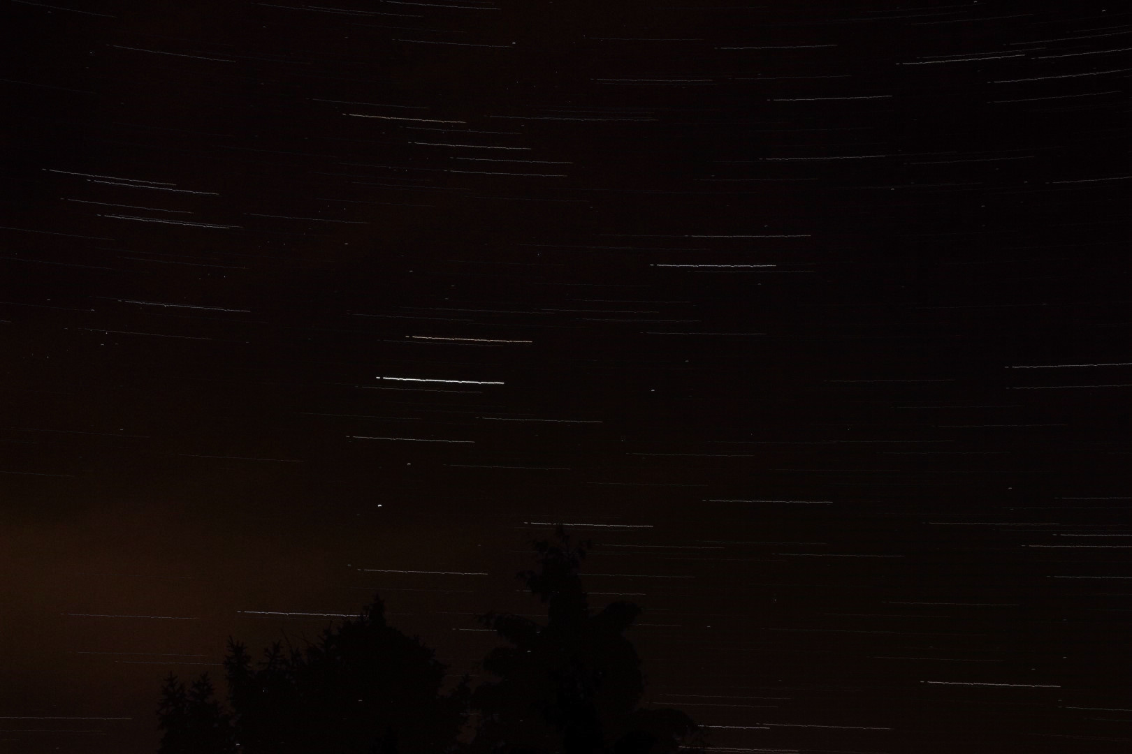
Conversely, what happens if we deliberately do not follow the sky’s objects in this way but hold the camera effectively still relative to the sky’s movement, created by Earth’s daily rotation. The answer is Star trails, which I set out to obtain the other evening. In order to achieve such a picture, the DSLR camera is fixed on a tripod and using an intervalometer, a long exposure of the night sky above is taken; alternatively a large series of shorter exposures can be made over a long period of time and then stacked to produce a better quality final image. As a result the stars trace their respective paths of light across the camera’s sensor, as the Earth moves at 1,000 mph on its axis. Such movement is normally indiscernible over short periods of time but through this process it is clear to see in the form of wonderful star trails. Of course the stars haven’t moved at all (at least not in a normal visual sense) it’s us that are moving, very fast. It is beautiful and clear evidence that we on Earth are continually moving through space!

Star trails (inverted colour)
Canon 700D | 20 minutes f4 @ ISO 800
Star trails
Canon 700D | 39x30secs f11 @ ISO 400
